
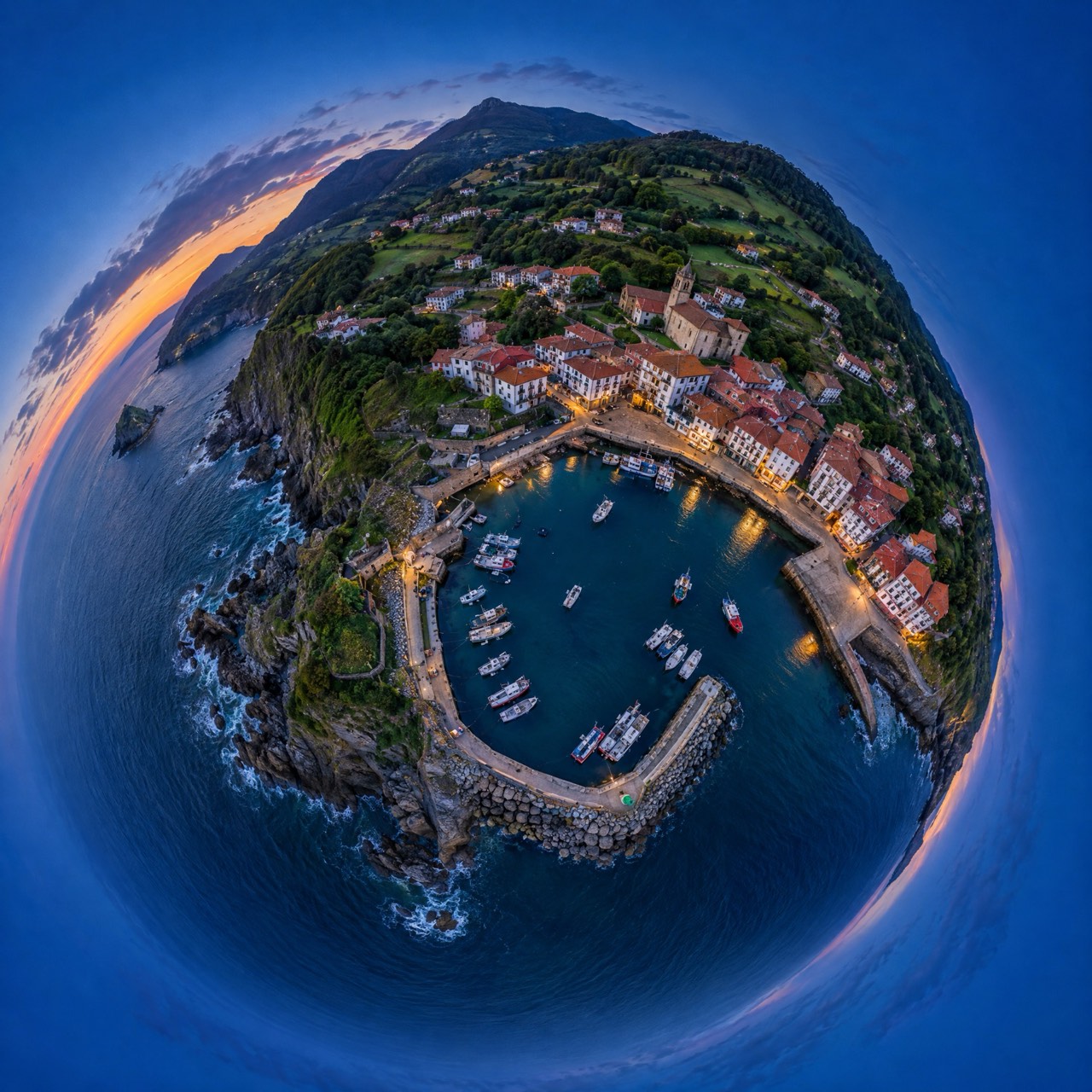
Aerial 360° panoramas and drone virtual tours
An aerial 360° photo lets you look in every direction from the sky: drag with your finger and see the beach, the metro or the nearest school. We set it in a web viewer with points of interest you can embed on your site, share on WhatsApp or link from a listing.
What's included
- Spherical 360° panorama from your chosen height (up to 120 m)
- Interactive web viewer with points of interest
- Embed code for your website
- High-resolution flat image and «little planet» version for social
Made for
- Real estate agencies
- Hotels and campsites
- Tourism and municipalities
- Golf clubs
- Developers
Starting prices, VAT not included, based in the Basque Country. Every flight is different: you get a fixed quote before the propellers spin.
Aerial virtual tours: the surroundings at a glance
Listing photos show the house; an aerial 360° shows where it is. It's what buyers and guests ask most, and what converts best in tourism: how far the beach is, what you see from the hotel, what the village is like.
Pricing
Each 360° point starts at €250; three points with viewer and points of interest, €650.
From a map pin to delivery
- 01
Brief
Send us the location (or a map pin), what you want to achieve and when. We reply with a flight plan and a fixed price.
LAT · LON · GOAL - 02
Permits
We check UAS geographical zones and handle whatever is needed: Interior Ministry, ENAIRE, heliports, ADIF or the landowner.
ENAIRE · AESA · EASA - 03
Flight
We fly with purposely chosen light and weather, within visual line of sight and with Remote ID. If the weather doesn't cooperate, we reschedule at no cost.
ALT ≤ 120 m · VLOS - 04
Delivery
Edited photos, finished video, maps, 360° panoramas or 3D models, in the format you need and with the coordinates of every shot when they matter.
JPG · RAW · MP4 · PDF · KMZ
Aerial 360° panoramas · Frequently asked questions
Where can I publish the 360° photo?
On your website (we provide the embed code), on social networks that support 360 and anywhere you can post a link.
At what height is it taken?
Between 30 and 120 m depending on what you want to show.
Other drone services
Permits are on us
Flying well isn't just piloting. We check UAS geographical zones and handle notifications with the Spanish Ministry of the Interior, ENAIRE (air navigation), heliport and aerodrome operators, ADIF (railways) or landowners. You just choose the shot.
We don't do thermal imaging, LiDAR, multispectral agriculture or light shows: they need equipment we don't have. If you need them, we'll point you in the right direction.
- UAS operator
- Registered with AESA (Spain)
- Pilot
- A1/A3 certificate, valid across the EU
- Aircraft
- DJI Air 3 · C1 class
- Identification
- Remote ID active
- Lenses
- 24 mm + 70 mm · 1/1.3″ CMOS
- Flight time
- Up to 46 min per battery
Where are
we flying?
Send us the location and what you need. We'll reply with a flight plan, the permits required and a fixed price.
Getxo · Bilbao · Basque Country — flying across Spain and Europe